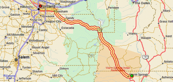
Tour Coda: To The Coast

September 22nd, 2007

Out: 90.86 mi / 6:53:17 time / 13.2 mph avg. / 36.0 mph max. / 3888 ft. climbing
In: 77.20 mi / 5:22:35 time / 14.3 mph avg. / 35.0 mph max. / 2796 ft. climbing
Stayed at Cape Lookout State Park

Joel (but you can pretend itAfter four days off the bike, during which I focused all of my energy expenditure on finding and eating every scrap of food within a three-mile radius, it was time to get back in the saddle again.

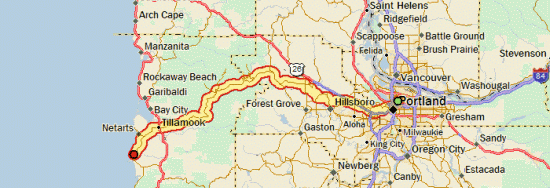
Joel had come home from Arizona on Wednesday night, so we decided that on Friday, we would head out together for the big blue sea, the western edge of the country: the Pacific Ocean. On Thursday I started coming down with the family cold, so I went to bed really early Thursday night and got 10 hours of sleep in an attempt to compensate. That helped a lot, though I still wasn’t 100% in the morning. On the other hand, I was able to lighten my load slightly for this trip, since I didn’t need to take my cooking gear, or most of my clothes. I still carried all five of my bags though, and since I was carrying some of Joel’s stuff as well, I was probably only a few pounds less than normal.

That meant that even with all the rest-and-recovery I had, the 1000-foot climb that starts immediately on the western side of Portland was quite a bear. It was easily the steepest extended climb of the trip, with lots of sections between 12 and 15% grade, plenty of switchbacks, and residents giving us nods of respect and congratulations as we toiled our way upwards at 5 mph. I was finally able to glimpse a backlit Mt. Hood when we neared the top of the hill.

Low Elevation, But A Big ClimbThen of course we gave all the altitude back as we descended and entered the sprawling suburbs and stoplights west of Portland, as well as some flat farm country. We made it to Banks and got an early lunch at Subway, which was my first Subway in a long time. From there we would take the Wilson River Highway up over the Coast Range, and then down to Tillamook. It’s a 1500 foot climb, gentle at first, then steep for the last few miles. By this point, Joel has slowed down a bit, unlike the first climb where I had to work just as hard as I normally do to keep up with him. Still, for a guy who hadn’t been riding much recently and really had no business doing a ride like this, he was doing remarkably well. And for me, it was kind of cool to relax and just dawdle (ok, not really!) my way up a hill for once. On the way up we got a honk and a wave from a blue Subaru going by: Chika and the boys were on their way to meet us at the campground.

After cresting the summit, it was mostly a long downhill through the Tillamook State Forest. We did have to fight a bit of a headwind, particularly once we exited the tree-covered mountains. A quick refueling in Tillamook (moreso for me; Joel was a little skeptical about the amount of calories he would be needing), and then in ten more miles we were at the park.

Chika had found a good site in the enormous campground (177 sites?), shaded, and a mere 50 yards from the beach. We got camp set up, including Joel and Chika’s monstrous 6-person tent (I’ll still be sleeping in my own, thank you!) and got dinner started (we’d borrowed a lot of camping gear from their neighbors, so I’d finally doing some fancy-cooking in camp! Ok, well, at least bratwurst!)

First Sight Of The OceanThen, before the sun set, I had to see the ocean, introduce my bicycle to it, and get a picture. It was pretty awesome to crest the small dune and suddenly see the breakers rolling in. I had carried myself to the edge of the world, or at least somewhere close to it. Just as I rolled the bike into the surf for the traditional “wheel in the water” photo, the ocean made it clear that it’s not something to be taken lightly, and sent a big wave up the beach that went high enough to flood my panniers, and worse, it got Joel’s cell-phone that he’d stowed in the outer pouch of my rain cover. The wave surprised the heck out of everyone else on the beach too, so at least it didn’t make me feel like a total landlubbing dumbass. What made me feel like a total landlubbing dumbass was when I propped the bike up on its kickstand in the sand, and another wave came along, and knocked the whole bike over right into the ocean. Neil Made It Too!Luckily the rain covers did an excellent job of keeping my stuff mostly dry, even though one of them managed to collect a gallon of seawater inside. By that point, I figured the ocean was trying to tell me something, and I did my best to wrestle the bike back up over the sand dune and back to camp.

After a good dinner, we tried another campground luxury, the campfire. Unfortunately, the wood didn’t seem particularly interested in burning, so it wasn’t a very exciting fire, but it was better than nothing. Joel, Chika, Noah, and Ren eventually got settled down in their tent for the night, while I stayed up for a bit having a beer and tending the fire. Then I went to see the ocean again. This time, alone on the beach, without the bike, and with the bright moonlight making the whitecaps shine above the dark water, it was a much more peaceful experience.

During the night I heard Ren wake a couple times, and there was a minor rain shower, but I slept just as well or better than I do most nights. Camping with two kids with a combined age of three certainly isn’t as simple as doing it solo, but overall, it went surprisingly well. No major disasters, and I think everyone had some time where they actually enjoyed it.

Breakfast!Morning was nice and comfortable, and brought more luxury fancy-cooking (pancakes and eggs). We got everything packed up into the car, including most of our bike gear. I took off my two front panniers and half-emptied my rear ones (we’d carried our own camping gear on the way out just in case Chika couldn’t make it for any reason). My bike was still covered in sand and salt everywhere, and I had to let Joel get a head start on the road while I flushed out my right shift lever, which had stopped working because of all the salt that got inside it.

It was weird riding back over roads that I’d already taken, but it was a beautiful day, with tailwinds this time, so I got over it. Lookout TowerWe were smart enough to take breaks a little more frequently this time, and natural/organic-food-eating silly-Portlander Joel finally gave in and recognized the necessity (and pleasure!) of calorie-dense foods that are easy to eat (ie: Little Debbies, or in this case, Dolly Madisons!)

Once we made it back over the Coast Range, we stopped at a small restaurant (with remarkably friendly and flirty waitresses!) for milkshakes, and then caught an incredible, smooth, steady breeze that allowed us to easily float down US 26 at 20 mph for nearly 20 miles. Then, to avoid that final 1000-foot hill back into Portland, we hopped on the light rail in Hillsboro and rode it twelve miles and through the tunnel instead (hey, my ride was done when I reached the ocean, so it’s not cheating!) A final four miles through downtown Portland where Joel whipped me once again over his home turf, and then my ride was truly and completely done.

Chika had had the genius to order in a big ol’ pizza, so I ate about half of that, and then took some of the extra stuff off my bike to make it easier for the bike shop to pack up and ship back to Chicago. I spent the rest of the night packing up a 43 lb. box of the rest of my gear to ship back via UPS, went to sleep, and when I opened my eyes again, it was time for Joel to drive me to the airport. Amazingly, the kids hadn’t woken up yet, so I didn’t get a chance to give them and Chika a proper goodbye, but the fact that they were still sleeping certainly had way more value at that point! It was sure nice to spend a relaxing week with them.

Then, it was into the airplane, towards home, where I would cover a day’s worth of bike riding about every seven minutes. Amazing.

Day 31

Tour Bonus Coverage – By The Numbers

September 19th, 2007

[Editor’s note: added a couple new numbers in response to comments. Let me know if there’s anything more I’m missing!]

20 – Number of days riding without a hot shower the night before. That means I took 9 showers during the trip. Seven were in motels, and two were in campgrounds. I think there were only two other campgrounds that even had showers, so there weren’t a lot of opportunities out there! I skipped those showers either because it was cold and rainy, or because sometimes taking a campground shower can be more disgusting than not taking one. Ten days was by far my longest showerless streak.

7 – Number of different beers sampled. Only one macrobrew, which is quite a good showing, due to the microbrew tradition of the Pacific Northwest, which has bled into Idaho and Colorado.

  • Miller Genuine Draft – Somewhere at a restaurant in South Dakota. Adequate
  • Fat Tire (New Belgium Brewery) – On tap at Applebee’s in Gillette, WY, and in a 22oz. bottle at Montour, ID. Good (the cold, tap one was better!)
  • Unknown craft-brewed Pale Ale – Bought in a single bottle in Canyon Village store and drank in camp. Excellent.
  • Mirror Pond Pale Ale (Deschutes Brewery) – On tap at Bear Bottom Inn, Mackay, ID. Unbelievably excellent.
  • Mt. Borah Brown Ale (Bertram’s Brewery) – On tap at Bear Bottom Inn, Mackay, ID. Good.
  • Black Butte Porter (Deschutes Brewery) – On tap at restaurant in John Day. I’ve bought this one in Chicago before, and it’s an excellent porter, and it was even better locally.
  • Hefewizen (Widmer Brewery) – 22 oz. bottle, cooled in the John Day River. Good, but a Hefeweizen isn’t really meant to be tasted out of the bottle.
  • 177.5 – My weight in pounds when arriving in Portland. That’s about 3 lbs. more than I weighed when I left, which seems to be my usual pattern for these trips. My body fat measurement is lower than normal, so there has apparently been some trading of fat for muscle. I’ve been following my normal post-tour pattern of continuing to eat enormous quantities of food, even though I’m not riding anymore. I’ve been weighing myself frequently just for fun, and my weight has fluctuated up to 6 lbs. in the last couple days. One night I lost 3 lbs. while doing nothing more than sleeping! I guess my body must be spending the energy doing all sorts of internal reconstruction work.

    39 – My resting heart rate in beats-per-minute. That’s the lowest rate I’ve ever measured. My pre-trip rate was around 50 bpm, and “normal” is around 70 bpm. That means my heart has gotten so darn efficient at sending oxygen around to my body that it can take a lot of time off between beats. Perhaps all the high-altitude training had something to do with it, but on the other hand, I never was able to detect any negative effects while riding at high altitudes. Then again, I don’t really have anything to compare to, because I’ve never really been able to try climbing a 9000 foot mountain while staying at sea-level.

    2 – Number of times I used my cell phone (a cheap used Nokia purchased and activated just for this trip). Once was to call ahead to a bike shop in Cody to see if they were open that day (the Sunday before Labor Day) so that I could buy tubes there (they weren’t). The second was to call Chika to let her know I would be arriving a day early.

    2503.34 – Distance that I rode in miles. How convenient that it’s extremely close to the nice round number of 2500 miles! For comparison, my Atlanta trip was 2132 miles in 30 days (27 days of riding, 3 days off), and my North Woods trip was 993 miles in 15 days (14 days of riding, 1 day off).

    83.4 – My daily average distance in miles. Slightly higher than my target goal of 80, but that means I was able to see a little more of the country (like the extra detour in Yellowstone) and still finish in 30 days. The 83.4 average compares to 71.1 for Atlanta and 62.2 for North Woods, but unlike this trip, I took some days off on those. If I ignore days off when computing the averages and count only the days when I rode, the numbers are 83.4 / 79.0 / 66.2. So this was my longest trip any way you measure it.

    10 – Number of 99+ mile days. I never expected that I would put in so many big-mileage days (the Atlanta trip only had four in this range). Most of them weren’t much of a struggle though, and just sort of “happened” naturally, due to good tailwinds, long downhills, or just a lot of time in the day without much reason to stop.

    6 – Number of flat tires. One was due to the valve stem coming out of the tube, so that doesn’t really count, and then I think two of them were caused by the same debris field (tiny bits of wire). Then I had one from a staple, one for an unknown reason, and one from something big and sharp that put a large gash in the tire. Given all the smashed beer bottles that litter the side of the road across America, I’d say that’s a pretty low number of flats. My 700Cx37 Schwalbe Marathon Supreme tires are looking pretty thin in the tread department after 3000+ miles on them, but overall I’d have to say they were well worth the expense. They also did very well on plenty of nasty gravel roads.

    7 – Number of nights I wussed out and stayed in a motel. That means I did 22 nights of camping, which is three more nights than the Atlanta trip, so I guess that’s pretty good. I always say that if I’m lugging all the camping gear across the country, I might as well make good use out of it. The motel nights were pretty concentrated in South Dakota and Wyoming, with two sets of back-to-back motel nights, and once three out of four nights. That means I did one stretch of ten straight nights of camping, which is a new record for me. One interesting related fact is that I stayed in zero private campgrounds. Every place I stayed was a state park, county park, city park, National Forest, National Monument, National Park, or Wildlife Management or Bureau of Land Management site. On the other hand, although I camped for free a couple nights, I did no ‘guerrilla’ camping at non-designated campsites. It’s amazing how helpful a simple table can be when camping, which is one thing that stops me from just camping off the side of the road.

    2000 – A rough estimate of the number of dollars I spent on the trip. In addition to food and lodging, that includes the flight home, and equipment I bought on the road, but not stuff I bought in preparation for the trip. Some people I met would say “hey, it’s cheaper than flying!”, but that’s true only if you look at it in per-day expenses. If I was just to fly to Portland and back and stay for a week, I could do it for a lot less than $2000! But if you look at it as $65/day for 30 days, that’s probably a lot cheaper than most vacations.

    2 – Number of items I lost on the road. That includes my sunglasses, which I lost presumably somewhere in Apple River State Park on my first night out, and my sweatband, which I think I must have dropped when I took a photo of myself at the top of the Bighorn Mountains, at 9066 ft. At least I left the sweatband in a place of honor!

    3 – Number of non-consumable items I bought along the way. Two replacemnt items, which were new sunglasses, and a new sweat device. This one was a Headsweats cap that covered my whole head, which was nice to have in the cooler weather of Idaho. The only problem with it was that the elastic left some pretty goofy-looking creases in my forehead at the end of the day, and it seemed to really accentuate my forehead tanline. The completely new item was a pair of Smartwool socks. It’s the first wool product I’ve bought, and while they’re very nice socks, I don’t think I’m going to turn into a wool freak (especially since it was a $17 pair of socks!) But they made camp a lot more comfortable because I could wear them with my shorts and sandals in the cool evenings and still be comfortable (fashion be damned!)

    0 – Number of things thrown at me out of passing cars. In fact, I can’t even recall a single instance of someone even yelling something at me. Quite amazing for a 2500 mile trip! The most annoying things were dogs in passing cars that would bark right in my ear as they flew past, scaring the bejeesus out of me every time. And if that’s the worst thing to complain about, I think that means it was a pretty nice ride.

    Tour Day 30: Warm Springs, OR to Portland, OR

    September 16th, 2007

    106.00 mi / 7:55:15 time / 13.3 mph avg. / 33.0 mph max. / 5058 ft. climbing
    Staying at Joel, Chika, Noah, and Ren’s House

    It turned out that the party house was much less annoying during the night than the group at the site next to mine who were up yapping and laughing until 2am. Luckily my earplugs do a pretty good job of filtering that stuff out, so I was able to catch enough sleep between wakings that when I woke for real a 6:30am, I felt fairly fresh.

    I crawled back out to US 26 on the bad gravel road, and then crossed into the Hot Springs Indian Reservation (I’m probably the only one who finds it funny that the town of “Madras” is the closest city to an Indian Reservation). Surprisingly there was a little strip-mall-ish thing there that said “FREE INTERNET”, so I pulled in to check on things. I had an email from my brother saying that he almost surely was in Arizona, which meant that he wouldn’t be riding out to meet me at Trillium Lake campground as we’d been hoping, to camp one night and then ride in together the next day. That was disappointing, but it left me with a decision: continue as planned and do 50 uphill miles and camp, or just blow through the whole 100+ miles to Portland in one day. My pre-trip planning focused on a 30-day ride, but that was always a very hopeful estimate, with the assumption that days off or other setbacks would actually make it more like 32 or 33 days. Since very early into the trip when I got off course a bit I had been targeting 31 days, but now, could I actually do it in the original 30? I figured I would make that decision once I got to the 50 mile point.

    When I blasted through the 1200-foot climb out of the Deschutes River valley like it wasn’t even there, I thought “ok, I’m totally going to do it all in one day”. Especially when I got to the flat section on top and was cruising along at 19-20mph. And then, out of nowhere, the wind came and slammed into me like a brick to the face. It was the strongest wind of the whole trip, and was mostly a crosswind, requiring all the skill and strength I had to keep the bicycle moving in a (relatively) straight line at 9mph. That’s when I thought “ok, I’m doing this in two days, and I’ll be lucky to even make it the 50 miles to Trillium Lake today”.

    Crossing The 45th ParallelHowever, after about 15 miles, I exited the open grassland and entered the forest, and the winds almost disappeared. I still had a lot of climbing to do though, all the way back up to 4000 feet. So I still wasn’t sure what I would do. Then, when during a break I semi-consciously ate one of my last two NutriGrain bars that I had been saving for the next morning’s breakfast, I realized that I had gone all in. I would be completing my journey today.

    I soon passed right by the turnoff to Trillium Lake, and then stopped at a rest area at Government Camp, where I had a lunch made out of all my remaining foodstuffs. It was from there that I gave Chika a call to let her know that I was coming in. It had taken me nearly seven hours (five of them riding) to cover the first 53 miles of the day; so I told Chika that I would be there at 6pm, which gave me three and a half hours to cover the same distance.

    And so I began my final segment of the trip, a 53 mile downhill that would drop me nearly 4000 feet. Though the winds held off, it did begin to rain just after I started, and would never completely stop. But at that I point, I didn’t mind at all. The only sad part was that, due to the clouds, I didn’t actually ever see Mt. Hood. So I guess it’s a good thing that I had the fake-Mt. Hood experience yesterday.

    Arrival!For no particular reason at all, I did those final 53 miles without a break (except for stop lights, and even then, I did the first 38 to Gresham without putting a foot on the pavement). I guess I figured I didn’t need to save myself for anything; there would be no riding tomorrow, after all! That meant that I rolled up into the suddenly-familiar driveway at 5:45, comfortably exhausted, to be warmly greeted by Chika, Noah, Ren, and Kai. Just a little 2500 mile bike ride to see my family, right?

    But stay tuned, the journal might not be over yet. As a coda, there’s talk of a ride out to the big blue ocean in the coming days. Also I have a wrap-up piece or two that I’m planning on posting. But for now, I think I’ll take a bit of a nap, if you don’t mind.

    Day 30

    Tour Day 29: Prineville, OR to Warm Springs, OR

    September 15th, 2007

    75.74 mi / 4:57:20 time / 15.2 mph avg. / 32.0 mph max. / 1113 ft. climbing
    Staying at Mecca Flat BLM Campground

    Largest Roadkill SeenToday would be an easy day, so I started slow in the morning, reading the copy of Outside magazine that was given to me by a fellow traveler in Stanley, and then doing a short hike through the pines. There had actually been a tiny bit of drizzle in the night, which sent me scrambling out of the tent to cover my bike seat and grab my shoes, but it stopped before anything actually got wet.

    The ride started with some LSD (Long Steady Downhill), which got me quickly into Prineville (pop. 9990, big city!) Did library’n’lunch there, where I suddenly discovered a campground just off US 26 near Warm Springs. I had been planning on a state park a good way off US 26 that would have given me a 60 mile day, but I quickly scrapped that and went for a somewhat longer day in trade for less mileage over two days.

    Mt. Jefferson (not Mt. Hood!)Halfway between Prineville and Madras, as I came over a hill, I saw a small mountain and thought, “hmm, that mountain has that low, wide, volcanic slope to it, almost like Mt. Hood. I must be getting close to those Cascades.” Then I looked a little to the left, and lurking behind it, a good eight times larger, “Holy shit, that’s Mt. Hood!” It was difficult to see through the haze and distance, but seeing those bright glaciers shining through was quite an overwhelming feeling. I think I rode the next three miles with a huge goofy-ass grin on my face.

    Only thing is, it turns out that it wasn’t Mt. Hood. It was Mt. Jefferson. D’oh! I discovered that fact as I passed to the north of it without ending up in the Columbia River. Well they look pretty darn similar, how am I supposed to know? It’ll be interesting to see if I feel the same way when I see the real Mt. Hood tomorrow.

    Mecca Flat CampgroundMadras is big enough for a Safeway, so I did my final good grocery stock-up, including a big sub and a beer that I would take to camp for dinner. The last five miles of the day (except for the two miles of gravel to camp) were down into the deep Deschutes River gorge, sending me to less than 1500 feet! I’ve shrunken down to 5-foot-8 here because the tremendous air pressure is squeezing me down! So I spent last night at the very top of a mountain, and tonight at the very bottom of one.

    The campground is also the complete opposite of last night’s: a field of burning dust being blown around by a hellish wind, and right next door is some kind of private party house with lots of barking dogs, so we’ll see how the night goes!

    Day 29

    Tour Bonus Coverage

    September 14th, 2007

    An Ode To The Commode

    Most of the campgrounds that I’ve been staying at lately have had only vault/pit toilets, which is basically a glorified hole in the ground that you poop in, with no running water involved. The interesting thing is that every vault toilet I’ve used from the Black Hills on west has been of a very similar design. It doesn’t matter if the campground is National Forest, National Park, Wildlife Management, or Bureau of Land Management, they must all use the same toilet designer.

    img_0788.JPGWhat makes that very exciting is that the toilet designer did an excellent job. In the Midwest and East, a pit toilet often means a ramshackle wooden structure filled with flies that smells really bad. In the North Woods I even had one that was just a wooden box with a hole in the top of it, right out in plain view!

    img_0790.JPGIn contrast, these are concrete-walled structures with solid, locking steel doors. They’re painted white inside for visibility, have a lot of room (they’re usually ADA-compliant), and they all even have a nice hook on which to hang your jacket. The toilet seat is comfortable, and the lids are used as the signs direct. They have no odor at all, except for perhaps the nice smell of an air-freshener placed inside. The last couple I’ve used have even been dual-units, with a central hall between them that shines electric light through internal windows. They have a curious built-in sign that reads “PLEASE… DO NOT put trash in toilets. It is extremely difficult to remove. THANK YOU”. “Difficult” is probably not the exact word I would have used to describe it, but hey, if it keeps people from throwing trash in there, then that’s super. As perfectly as everything else is designed, I’m sure they researched that sign very carefully to determine the most effective deterrent.

    On the last couple of windy days, I’ve noticed one unexpected surprise of the vault toilet: a good breeze will blow into the external vent stack and give your bottom some nice air-conditioning from below. For free!

    An Ode To The Commode

    O, my wonderful Western toilet
    Not even the most fearsome log can spoil it
    Some call you pit, some call you vault
    By any name, you are a can without fault

    Smells sweet
    Cool seat
    Made of concrete

    We all must heed nature’s call
    So this is a stall that can handle it all
    And when you’re in a rush
    You need not remember to flush

    [Editor’s Note: The main text was written several days ago, but the poem was only composed when inspiration struck, which was yesterday, during the 2000-foot climb up to Ochoco Divide]

    Tour Day 28: John Day, OR to Prineville, OR

    September 14th, 2007

    83.58 mi / 6:44:50 time / 12.3 mph avg. / 35.0 mph max. / 4568 ft. climbing
    Staying at Ochoco Divide National Forest Campground

    To show the world (by which I mean, nobody) that even a day like yesterday can’t wear me out at this point, I took advantage of the slight downhill and slight tailwind and blasted through the first 32 miles to Dayville in well under two hours, in another No-Stop morning. I fueled up there with a hearty 2nd-breakfast, since I would be needing the energy for the next 50 miles. Dayville’s gas station is a Little Debbie shop (Texas Cinnamon Roll, Cherry Pie, and Fudge Round), and my milk carton actually said “Thank you for buying local East Oregon milk”, so yay!

    Picture GorgeThe descent ended at Picture Gorge, part of the John Day Fossil Beds National Monument (this John Day fellow is rather popular around here). While most of eastern Oregon has been quite scenic compared to a place like Illinois, with hills and mountains all over the place, this was the first “wow” area; it’s quite a badass canyon, and that’s coming from a guy who has been through more than a few. Halfway through the canyon, after following the John Day River downstream all morning, I made a left turn at a three-way river intersection and began following a tributary upstream.

    The Oregon Mountain Climbing Efficiency Board held an emergency meeting last night, and decided that days like yesterday’s four 1000-foot climb day didn’t make any sense, so for today they compressed it into just two climbs. The tradeoff is that now they were both 2000-foot climbs. The first one was long, at 25 miles, but then of course not very steep for much of the way. It’s interesting to watch the vegetation change with the altitude on these climbs, and the last couple days my friend the fragrant juniper has even returned. Mitchell, ORThey were repaving a long section of the road, but the one-way area didn’t begin until right at the pass, so I was able to ride through it taking advantage of the downhill.

    Lunch was at a (I mean, “the”) cafe in Mitchell, another in a long string of incredibly small towns, and then there as a bit more downhill to go until I started climb #2. Ochoco Divide National Forest Campsite This time, the one-way section started at the uphill, so they had to put me in the truck for a bit. But it was less then four miles, and only about 300 feet up, I so don’t feel like I was cheating too much. This time when the pilot truck driver announced my ride over the CB, a response came back, “I think I’d have to be retarded to do something like that!”

    From there, it was just 2000 more feet of climbing, this time at 5-6%, until I got to Ochoco Divide Campground at the very top of the pass. There’s a bicycle section here, and the web says it’s $4, but the sign says it’s $12 just like everywhere else, so I just took a normal site so I could have some flat ground to pitch my tent. The campground is filled with some pretty enormous 200+ year old pine trees, which makes it a pretty cool spot.

    Day 28

    Tour Day 27: Vale, OR to John Day, OR

    September 13th, 2007

    113.86 mi / 8:36:32 time / 13.2 mph avg. / 39.5 mph max. / 5863 ft. climbing
    Staying at Dreamers Lodge Motel

    Yesterday at the grocery store in Vale I talked to a little old lady (her words!) riding her Schwinn who was trying to discourage me from camping at Bully Creek, because it meant I’d have to come all the way back east to Vale to get back on US 26. Apparently she’s just too much of a wuss to handle the 8 miles of gravel road that I ended up taking north to the highway. C’mon, grandma! Ok, so “gravel” is used a bit loosely out here; there were quite a few sections piled with 6-inch round river rocks, which I somehow managed to ride over. And then some sections of sand too, which I didn’t. But hey, it’s all fun as long as no one pops a tire (and I didn’t).

    So I was all satisfied with myself for surviving on my own planning skills, until I got to Brogan, which was a destination she had suggested (“you’ll have the wind blowing you that way”) and saw that they had a not-bad-looking RV park/campground with showers and laundry for $10. D’oh. But I have hard time trusting people out here, because most of the time I’ve done so much planning that I know more than they do. Case in point, there were a couple of good ol’ boys sitting outside the gas station in Brogan, and GOB #1 says “well, you got less’n 300 miles to go now!” GOB #2 corrects him, saying it’s more like 400 (and he’s closer to the truth). But then GOB #2 says “well once you’re past Dixie, it’s all downhill”. “Oh yeah? Where’s that?” “mmm, about 40 miles”. Well, it’s more like 70, but see, I already knew that.

    Eastern OregonSo just after Brogan, I had to climb a 1300-foot hill, which began what a clerk in New Plymouth referred to as “The Passes”. I didn’t really know what that meant then, but now I’m pretty sure this is what she was talking about: four ~1000 foot climbs, some with descents following. Brogan Hill at 3941 ft., Eldorado at 4623, Blue Mt. at 5109, and Dixie at 5277. All that adds up to a day with nearly as much climbing as my day over the Bighorns, and a lot more distance covered. But it also makes for an interesting day with no time for boredom at all. And GOB #2 was right, once I crossed Dixie at 91 miles, the next 22 were all downhill.

    After the Brogan Hill, I decided to pump up my tires, and then realized I should have done that days ago, because suddenly I was flying. But then 10 miles down the road I got a flat (from a staple), which maybe wouldn’t have gone through the tire if it was under less pressure. So does it all even out? Maybe as far as time goes, but I guess my energy expenditure is still less.

    Oregon Pass #3At Austin Junction (where I had a great ice cream cone), I met my first non-Yellowstone touring cyclist, going the other way. He was originally from Wilmette, and had this weird Extenda-Bike thing that stuck his wheel way out the back so he could mount two really long rear panniers, sort of a pannier/trailer hybrid. Austin Junction is also the point where my pre-planned route shows me getting off US 26, but a couple days ago I made the decision to just take 26 the whole way. Even though it looks less direct, it’s only about 2% farther, with a lot less climbing, and I figured probably a few more people and services (as it is, US 26 is easily the least-traveled US highway I’ve been on).

    Coming Down From Dixie PassThe downhill stretch continues past John Day, so I could have easily made it to the state park eight miles down the road (both in terms of daylight and energy), so it was a tough decision whether to continue on or not, especially since they have $4 hiker/biker campsites there. For some reason I decided to just go with the motel, I guess because I realized I’m the only one who cares about the “Camped The Last Two Weeks Straight Without A Motel” record.

    Turns out it was a good decision, because the town of John Day loves me. First, the girl at reception told me about 18 times “If you need anything at all, just come by and let me know”. Then as I was walking to my room, I talked with a guy who has ridden all around Oregon and Washington, and he gave me some route advice. Then as I made my way to my room and was opening my first-floor door, the motorcyclist who had been checking in just before me said, “you must be better-looking than me; she told me they didn’t have any first-floor rooms left!” Finally, my favorite: just as I was closing my door, another guy who I’d just briefly spoken with at reception popped by and said “hey, I don’t know if you partake, but if you want to smoke some pot later on, you’re welcome to join us!” I thanked him, but politely declined, and instead went to dinner with the cyclist guy and his friend, who were generous enough to treat me both to a meal and some good cycling conversation. Both have broken the 100,000 lifetime-miles barrier (which is one of my long-term goals) and are still riding, so that was inspiring. Now I’ll go to sleep, and see if I wake up smothered in a pile of money and hookers.

    Day 27

    Tour Day 26: Montour, ID to Vale, OR

    September 12th, 2007

    71.56 mi / 4:37:42 time / 15.4 mph avg. / 27.5 mph max. / 1285 ft. climbing
    Staying at Bully Creek Reservoir County Campground

    House On A Hill, Near Montour, IDIt was nice to not have to worry about freezing to death overnight, and the morning was a full 20 degrees warmer than the previous morning. I headed out of the Montour Reclamation Area through the ominous Black Canyon, and once I was through the canyon, I was suddenly back in Iowa! Perfectly flat, with straight roads laid out on a 1-mile grid, cornfields, and even a herd of black-and-white Holstein dairy cows, which I don’t think I even saw in Iowa. It seemed odd that a whole lot of places I passed were watering their lawns; they must have some kind of “use it or lose it” policy for irrigation water, so everyone decides to use it.

    Crossing Into OregonSince it was flat and there was no wind, I was making really good time, especially since I did the 30+ miles to New Plymouth without even stopping for a break. Then I crossed the Snake River and entered Oregon, my final state to cross. I was immediately greeted by a cool and unexpected surprise: a bike lane! But then a minute later, that was balanced out by an uncool greeting: billboards advertising the horrors of meth addiction (I guess I’ll be locking up the bike more often!)

    Ontario felt like the biggest city I’ve been in since at least Gillette, WY, and maybe even Rapid City, SD. Certainly the first traffic lights I’ve seen in over a week. But apparently not big enough for the library to open before 2pm on a Wednesday, so I sat outside with another guy and used their WiFi from there. Due to the time I was making, I was toying with the idea of putting in another 100+ mile day, but instead I decided to use the extra time to do some much-needed laundry. My clothes didn’t really stink too bad (except for my shoes, which might be forever damaged by those first days of wetness), but they were all crusty and caked with salt. Conveniently, I could also reach an open WiFi hotspot from the laundromat (I don’t think it was theirs), so I was able to be pretty productive.

    Then I did a late lunch at McDonald’s, and cruised the next 15 miles along US 20/26 to Vale. Among the items I got at the grocery store there was a loaf of Goldminer California Sourdough Roasted Garlic Bread. I figured I’m only one state away from California now, so it’s appropriate. Then in camp I read the label that says “Maple Leaf Bakery, Inc., Des Plaines, IL”. I guess I’m not doing a very good job of eating locally! (and I did finish the whole 780 calorie loaf tonight, along with a can of Chili-Mac, a can of Noodle Soup, a Nutty Bar, a Pepsi, and a Toblerone).

    But the most exciting event of the day was….a shower! The first one I’ve had since Cody, WY, 10 days ago. It took three rounds of shampoo on my hair before I could even get a lather to form. So combine that with the laundry, and I’m a clean machine, ready for the final push to the end!

    Day 26

    Tour Day 25: Stanley, ID to Montour, ID

    September 11th, 2007

    [Editor’s note: ok, ok, new pictures!]

    117.18 mi / 7:52:13 time / 14.8 mph avg. / 35.5 mph max. / 3291 ft. climbing
    Staying at Montour Campground (Bureau of Reclamation)

    Stanley Lake @ 24 deg. FTwo pairs of socks (short cycling socks and long warm Smartwool), four bottoms (cycling underwear, full-length tights, Windstopper pants, baggy shorts), three tops (long-sleeve zip-top, t-shirt, jacket), two hats (a face-covering balaclava and sweatband hat), and full-length gloves. That’s what it takes to survive a night where the temperature dips down to 24 degrees (the lowest reading I saw on my thermometer was 27, but that was after the sun was up, so I bet it did get down to the predicted 24). And with all that, I actually slept pretty well. Even better, getting up in the morning is pretty easy, since I already have all my clothes on!

    Stanley Lake, IdahoAnd what a sight to awaken to! The haze was gone from the sky, so the rising sun was lighting the sawtooth peaks quite dramatically, as tendrils of mist were rising off of calm Stanley Lake. Hopefully the camera saw it as well as my eyes did.

    I was out of camp a little after 8 AM, and I had one last push up a hill for the first 20 miles, and then I would go down, down, down. The Wind Gods had taken another day off, so what little wind I felt was changing direction aimlessly and not affecting much. I crested the hill at around 7000 ft., and then caught up with the South Fork of the Payette River, which I would follow down the mountain. The area I was riding through truly National Forest land. National Forest SignageIn many National Forest areas, there are lots of private lands within the boundaries, so it hardly feels different than any other road. But I rode 46 miles before coming across the first private parcels (so it’s a good thing I had plenty of breakfast to get me that far!) There are also about a million campgrounds and trails; I could spend weeks exploring the area.

    I got lunch in barely-a-town Lowman, from the store which is set up inside of a trailer. After that, my “riding along a river is good riding” rule was violated, as I climbed a huge hill that eventually took me 500 feet above the river, even though it was still right next to me. I guess the river canyon is just too narrow to fit a road down there too, so the road has to ride up the mountainside. Sawtooth National Recreation AreaThe up and down pattern continued, but there were more downs than ups, and climbing hills actually makes the riding seem to go by faster anyway, since I’m constantly changing my approach and doing something different. I’d heard yesterday that they were closing the road between Lowman and Banks from 5-9 pm each night for fire-related activities. So I was a little concerned about that (and more concerned about the reported smokiness and my ability to breathe), but I didn’t see any evidence of impending closure, or smoke. I saw a helicopter carrying a bucket fly by, but that was the only fire-suppression activity I noticed.

    When I headed south out of Banks, I discovered a new type of rumble-strip, this one designed to irritate drivers instead of me! It was right down the center double-yellow line in the road, I guess to really discourage passing in no-passing areas. Luckily, they seemed to annoy drivers less than they annoy me, so the drivers generally had no problem rumbling over them to go around me and pass.

    Judging by all the rafting outfitters and the size of the parking lots and the signs warning about congestion near the put-ins and take-outs, this Payette River must be one heck of a popular place for whitewater rafting. I didn’t actually see anyone on the river today though.

    117 Miles And A BeerWhen I got to Horseshoe Bend, I went looking for the Subway mentioned on the town’s website, but it was nowhere to be found. Since I didn’t feel like dinner at a steak place, I had to settle for the grocery store and dinner in camp. I’d already gone too far south looking for the Subway, so I decided to take the direct, gravel-road route to the campground and save myself a few miles and two river crossings. It turns out that it was quite an adventure, with a lot of unnecessary 8% grades to climb (again, I’m still following the river). But I was feeling unusually strong from mile 80 on until the end, so it was no big deal. Was it the Cherry Garcia bar I got in Garden Valley that fueled me? Or was it spending weeks riding at well over 5000 ft, so now I’m getting oxygen-overload down at 2500 ft.? My only concern was that I wanted to cover the 8 miles before my 22oz. Fat Tire beer got too warm! I can’t figure out why that beer is so widely available, but since it’s better than most, I won’t complain. And how could a beer get too warm after a 24 degree morning? Well, the temperature had probably increased at least 60 degrees throughout the ride, which is one hell of a swing.

    So with that, I say goodbye to the Rocky Mountains (though not mountains in general). I haven’t been this close to sea-level since before the Black Hills. Thanks guys, you treated me fairly, and gave me more than I could have imagined. I hope we meet again sometime!

    day25.gif

    Tour Bonus Coverage

    September 10th, 2007

    Since I had a short day and lots of extra time yesterday (and today), I was able to write up responses to a bunch of comments and emails. So here they are, in one big pile!

    “Joel asked: Where were those heads of Reagan and Bush?” That was on the way to Mount Rushmore. I didn’t get closer to investigate, but I’m guessing it was some sort of proposal for Mount Rushmore Part II? Or the anti-Mount Rushmore? To be fair, hiding behind Reagan was also a bust of Kennedy, but when I approached it I saw it just like the photo (and adding Kennedy almost makes it weirder, if that’s possible!)

    Jean asked “What are the bugs like in SD? Were they bad in Iowa? I would think with all the rain you had at the beginning they must have been awful. Hope you have lots of bug spray with you.” I think there might have been two nights (probably in Iowa) where I noticed mosquitos, and only one where I actually used insect repellant. Beyond that, there have been so few bugs that I haven’t even been concerned with keeping my tent door closed (which is normally a priority in mosquito country). In Wyoming there are areas with tons of grasshoppers sproinging all over the place, and atop the Bighorns I saw these enormous freaky black Alien-like things (getting eaten by grasshoppers), but nothing that actively bothers me. Oh yeah, there are also these weird flying things that make this really loud clacking noise as they’re randomly darting around. That was mostly a Wyoming thing, but there are still a few in Idaho.

    Dana said “don’t play w/the racoons at the campsites. They are mean – seriously.”
    Surprisingly, I haven’t seen or heard any campground raccoons in the whole trip. Plenty of dead ones on the side of the road, so I know they live out here (although lately I think I’ve been seeing more dead porcupines than dead raccoons). Maybe the campgrounds I’ve been staying at are just too well-maintained to attract raccoons. I guess if you’re building your trash receptacles to keep bears out of them, that also keeps raccoons out by default.


    Dana said “I suggest the Star Crunch and the Peanut Butter Twix-like one. They are my faves”.
    On your recommendation, I tried the Star Crunch way back in SD (I think their website even says it’s their most popular or something). Sorry to say, it didn’t work for me. It has some kind of caramel-y goo inside that rubs me the wrong way. On the other hand, the Nutty Bar (which I assume is the Peanut Butter Twix-like one) is superb. I’m not really sure why I didn’t eat them before now. It might be because my best friend from grade school would have them at his house regularly, so it didn’t have the exotic, gourmet allure to me that all other Little Debbie products have. But boy, was I missing out!

    Dana said “Ok, stupid question from the e-journal challenged, here: Once I post my entry by clicking