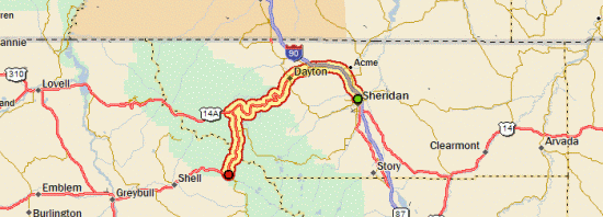
Tour Day 15: Sheridan, WY to Shell, WY
September 1st, 200764.83 mi / 6:16:50 time / 10.3 mph avg. / 34.5 mph max. / 6261 ft. climbing
Staying at Cabin Creek National Forest Campground (7600 ft.)
 Ok, so today is the day that I finally tackle the giant spike that’s been looming in my elevation profile for the last two weeks. It looks scary, but I’ve tried to do everything I can to tell myself that it’s doable: sure, the grade goes on for 18 miles without a break, but it never exceeds 6%, which is well within the range of my gears (that means I can do normal, aerobic pedaling the whole way); other people who aren’t in as good of shape have done it before and survived; and as long as I’m climbing a hill, that means I’m going slow, so winds aren’t much of a factor, and any day when winds aren’t a factor is a good day (yes, this rambling is what my thought-process sounds like in my head).
The ride started with a 20-mile warmup from Sheridan to Dayton. Although there were some minor grades, it’s remarkable how flat the route stays even as you get really close to the giant mountain range. It even goes down sometimes! Along the highway there were all these “Port Of Entry / Must Stop” signs. I can’t figure out what that was all about; is there an ocean nearby I’m unaware of? I stopped at Dayton for my final fuel-up, where it seemed that everyone and their uncle was stocking up in a similar fashion to head into the mountains on this beautiful Labor Day weekend (even though they have trucks to get them there!)
 Then, right out of Dayton, it begins. 4% at first, but quickly up to 6%, though the road stays fairly straight for the first few miles. Then, the switchbacks start, where I see pickups and RVs creeping back and forth across the face of the mountain way above me. I naively think “Crap, I have to get way up there?”, even though “way up there” is hardly very high at all yet. I try to stop as little as possible, since starting again requires such a burst of energy, so I stop at mile 6, mile 10, mile 15, and then, I’m at the top! Well, almost at the top. After a brief downhill, the grade continues, but a much lower slope. I went high-tech and used a couple PowerBar gel packs to help get me up there, but otherwise it was just a couple bananas, a bunch of peanut M&Ms, and dried apricots. And lots and lots of water. Around 6mph the whole way, so it took about 4 hours.
 Then I made it to the Bighorn Lodge at Burgess Junction (elev. 8300 ft.!) where I had lunch and stuffed myself way too full. I actually think the 10 miles I did after that at 2% to reach Granite Pass (9066 ft.) might have been the hardest, since I was all fat and bloated (and no, passing gas doesn’t actually propel you forward any faster!)
Then, it was time to fly down the other side for 7 miles or so. Given all the recreational traffic I saw all day (there must be 8000 4-wheeler ATVs in these mountains, since it seemed like every other truck was hauling up one or two), I was concerned that the all the campgrounds might be full.  Turns out I had no trouble getting a spot at the one I was shooting for, but the host here said most of the other ones are probably full; this one just isn’t very remarkable or near any exciting features, so it never fills up. But my site is right next to the eponymous Cabin Creek, where I took a quick half-bath in the cold water, and then found a comfortable perch amongst the rocks to read a Car & Driver (it’s impossible trying to find a copy of The Economist out here!) Though it was still quite warm when I got here (around 5:30), the temperature dropped fast when the sun set. It’s not supposed to get too cold, but on the other hand, hopefully the smoke that’s been blowing over the top of the range all day isn’t followed by fire during the night!
September 3rd, 2007 at 9:47 am
Nice job! Now that you made it over the Big Horns, I figure that you’re home free.
September 3rd, 2007 at 2:05 pm
Neil,
Lewis and Clark and The Corp of Discovery also hoped to find an ocean near the same place you were only to discover more mountains. The Port of Entry signs refer to a place that trucks must stop when entering from another state to be sure they are legal with permits, weight, etc. Montana is only a little ways north so it adds up.
Phil Nesius
September 5th, 2007 at 2:21 pm
Great climb, Neil !!!!!!!!!!!!!!!!!!!!!!!!!!!!!!!!!!!!!!!!!!!!!!!!!!!!!!!!!!!!!!!!!!!!!! 🙂
Any chance you stuffed yourself with an El Famous Burrito at Bighorn Lodge/Burgess Junction? Hope you aren’t reading this if you’re hungry and have only crumbs left from Little Debbie snacks.