Day 24: Lake Isabella, CA to Tehachapi, CA
September 26th, 201260.0 mi / 6:24:47 time / 9.3 mph avg. / 7132 ft. climbing
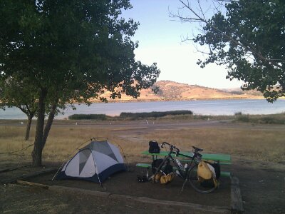
Staying at Brite Lake Recreation Area
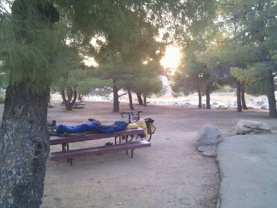
Last night’s enormous campground was deserted, as far as I could tell, so I was surprised that when I went to get an envelope to deposit my $20 fee, the sign said nope, no envelopes, a uniformed ranger will stop by to collect. Uh, yeah, fat chance of that. I had all the privacy I needed, so I spent another night out on top of the picnic table, and of course no ranger ever appeared. Given the complete lack of motel-nights and the dozen or so campgrounds where I’ve paid $5 or less, this is turning out be my cheapest bill for lodging ever on a tour. Not so for the beer bill, however!
After spending what seems like weeks on nearly empty winding mountain roads where no cars pass you faster than 20 mph, it was quite a system shock to start the day with all the morning commuters hustling between the towns surrounding Lake Isabella at 60 mph, on a shoulderless road. I stopped at the McDonald’s in the town of Lake Isabella for breakfast, not for the taste, but for the speed, convenience, and WiFi. Seems like the first town in forever with chain stores. And geez, $4.99 for 1400 calories of Deluxe Breakfast? It’s hard to beat that, and made my $3.69 350 calorie smoothie look like a complete ripoff in comparison!
Today’s distance wasn’t long, and there were no giant mountains, but there was still a ton of climbing as the route basically bashes its way out through the folded southern foothills of the Sierras. There was also very little civilization, so I made sure to carry a Gatorade out of Lake Isabella along with my 3 water bottles.
The morning half of the ride was three climbs in the 1000-foot range, and since it was back on less-than-state highways (the Bodfish-Caliente Road), that meant sections of 10+% grades again. It seems like my phase of engine-difficulty is now well-past, so while it was hard, it was fun-hard, not sucks-hard. The route out of Lake Isabella continually informed me I was on a Dam Failure Evacuation Route. Pretty much the same idea as the Tsunami Evacuation Route signs from the Oregon coast I guess, though this disaster would be man-made. I found it curious that even though I’ve passed downstream of a few big dams now, this is the first I’ve seen such signs. Are those living downstream from Pine Flat Lake or Lake Kaweah just unconcerned, or is the Lake Isabella dam more likely to fail?
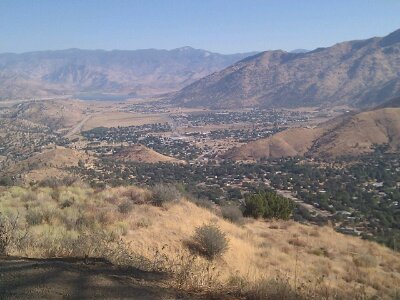
The last climb was on a road that only appears on Google Maps if you zoom in really far. It’s odd, because the roads are like a lower-case ‘b’, where you start at the top of the stem, and want to get to the bottom. Google by default will take you all the way around the curve to get you there, rather than just continuing straight down. Usually that means the road is dirt, has a 40% grade, or is populated by an army of Nazi separatists waiting to shoot anyone who crosses their lands. I had done enough research to know none of that was true, but was still a bit nervous about what I’d find. What I found was a perfectly normal mountain road, in better shape than many I’ve been on recently. Weird.
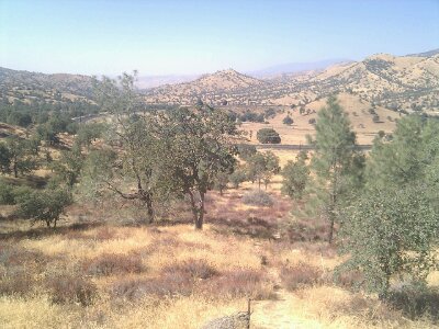
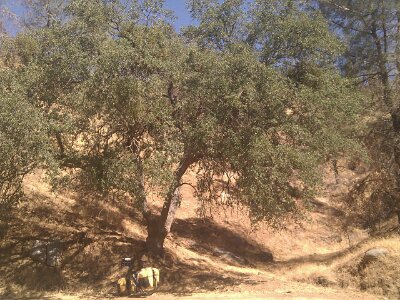
It was all much more pleasant than I’d been expecting, largely because I was playing between 3000 and 4000 feet, so this open mountain rangeland was more oak chapparal than dessicated grassland. On the way down the big descent of the day that would take me to a place with no services ominously called ‘Caliente’, at 1300 feet, I spent a few miles pulsing the brakes trying to find the perfect oak tree casting the perfect shade on the perfect rock to sit and have some lunch. I think I found it a couple times, but too late, I was already too far past down the hill. The third maybe wasn’t quite as perfect, but it was still pretty good, and more importantly, I was able to stop for it. Even at the bottom, in full sun, I don’t think the temperatures broke above the mid-80s today, so I guess you’re not so ‘Caliente’ at after all, but huh?
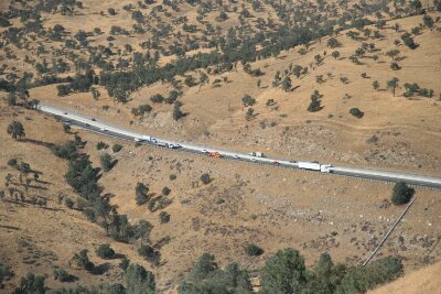
One last brutal climb up from Caliente, and I made it to CA 58, effectively a superhighway headed up the mountain from Bakersfield. Sign said bicycles are not allowed. Hmm. I’m pretty sure this was on the Adventure Cycling Route, and I couldn’t believe they’d send anyone down a road illegally. I pulled out my maps to investigate if there were any alternates. I wasn’t worried about breaking their rules, but there was an endless mass of semi trucks grinding and huffing and roaring and wheezing up the hill in both lanes (literally more semi trucks in 5 minutes than I’ve seen the entire trip, it was astounding), often with their hazard lights flashing, and it made me wonder of the huge shoulder disappeared or something else strange like that. Then I noticed a big cell tower right next to me. Internet worked, and a quick search for “Adventure Cycling Sierra Cascades SR58” brought me to a thread at their forum where a local said he rode it once a week and never had an issue, and AC said the sign was put there in error and CalTrans had been informed. Alright! You’re awesome, Google! Onward! (a county sheriff did in fact pass me, and gave me no trouble).
Though the semis were struggling up the grade, it was a lot easier for me than what I had been on, so I was a bit sad to leave it when the local alternate appeared and dropped me into the town-in-a-building of Keane. This “town” was missing the gas station and 90% of the general store, but I was able to get the waitress to give me two big scoops of oh-so-good vanilla ice cream in a Styrofoam box (she thought I wanted it to go for some reason), and she filled my water bottles.
During the big climb to Tehachapi that followed, when I realized this was going to be yet another 7000+ foot day, I started telling myself a story to remind myself what 7000+ feet of climbing really is, and just because it seems to be happening frequently, that doesn’t mean it’s normal, and it’s important to remember that’s why this trip seems like so much work. It goes something like this:
Go down to your local bowling alley and pick up a 15 lb. ball. Feels like a nice heft, right? Now put that in a sack, and find 2 more to add to the sack. Do the same with a second sack, filling it with 3 more 15 lb. bowling balls (make sure you have some strong sacks!) Now pick them up, if you can, and walk over to the Sears Tower. Stand at the base and look all the way up to the top. Think about making it to those miniscule glass ledges way up there with all your bowling balls. Then stack four more Sears Towers on top of the first one, and imagine making it to the top of that. Of course there is no elevator, and remember, no air-conditioning in the stairwell either.
That’s a bit what 7000+ feet of climbing is. Of course I’m lucky that my 90 lbs. of bowling balls are sitting beneath me, so I don’t have to lift them as well as move them. And a bicycle, utilizing the ancient inventions of wheels and gears, is an incredibly efficient machine, so it moves with a lot less energy wasted than you trudging up an endless staircase. But still, that exercise helped return to me some perspective, and better, while thinking about it, 1000 feet had passed without me noticing it!
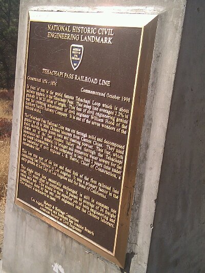
A railroad was running up the hill between me and SR58, and I soon came to one of the “Seven Wonders of the Railroad World”, the Tehachapi Loop, where the rail line does a complete circular loop over itself, roller-coaster style, in order to gain the necessary altitude without killing the trains. In other places the line also snakes back and forth to reduce the grade, which is something I do too when restarting from a stop on a hill that was just too much: I start riding perpendicular to the road to gain some forward momentum before turning uphill again. A marker noted that this rail route, completed in 1856 linking San Francisco and Los Angeles, greatly helping the growth of LA, averages a 2.2% grade. Oh, 2.2%! I’m so impressed! I wish my hard routes were 2.2%!
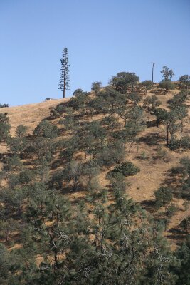
Can you spot the cell phone tower? It might actually work 2000 ft higher where there are trees like that. Points for at least trying though!
Once I crested the hill, the empty road I was on suddenly became filled with traffic. Wait, how is this possible? I hadn’t passed another town, or a factory, or anything that explained what was suddenly sending all these people to-and-from distant Tehachapi. Oh, it was the houses. It was the “community” of Golden Hills, with houses sitting on big giant plots of land, not because they were doing ranching or farming, or because there was no room closer to the nearest businesses miles away in Tehachapi, but just because. So all of these people were running back and forth, probably 6 times a day, carrying at least two hundred bowling balls with them wherever they went. Of course not even the strongest and healthiest human can move that many bowling balls under their own power, so instead, they dig up rotting dinosaur meat from the ground and explode it to push themselves forward. Even if they don’t run out of dinosaur meat, the explosions are likely making their already-hot-and-dry lands even hotter and drier, and the whole thing just seems totally unsustainable. There was a nice bike lane along the road, but was there anyone but me on it? Do you even have to ask?
There has to be a better way. As hard as I work and as much energy as I take in and put out to move my bowling balls forward and up the Sears Towers, everyone else has to put out tens or hundreds of times more energy than that. Those semi trucks grinding up that hill were exploding so many dinosaurs that I’m surprised it wasn’t raining dinosaur blood from the sky, but on the whole they’re way more efficient than the guy in his Durango driving 10 miles to pick up a pack of smokes. The trains going up the 2.2% grade are even more efficient, so much that the sign says 36 trains a day still use that line constructed in 1856. Unfortunately that’s still not nearly enough, and the huffing-and-puffing trucks have to carry all the rest of the stuff that overflows from the trains. And what is all this stuff? I’m sure a lot of it is quite necessary, like the bread and cheese and ice cream that kept me alive and moving today. But all of it? Living for a month (and living an awesome, liberating, and joyful life) with all your possessions in the equivalent of two bowling-ball sacks really makes our addiction to stuff seem ugly and stupid and counter-productive. But of course I should not be casting the first stone, as I have often thought while riding how fun this same route through the mountains would be in my dinosaur-exploding Miata. Argh, hopefully we’ll learn and grow past this adolescence before it becomes too late.
Okay, back to the ride! I finally made it to some non-houses in Tehachapi, where I got my second early-dinner in a row. Mexican this time. Shut up, yesterday wasn’t “Mexican” just because it was tacos! This was full-Mexican, chips-and-salsa, margarita, enchiladas, and… a salad? I guess that’s how they roll here in Tehachapi. At the next table, a 60-something man spent their whole dinner regaling his poor date (?) with tales of every fight he had been in (or nearly been in) in his life. The short ride to the campground was surprisingly difficult, both because it reached the high point in the day and because it was into a strong wind. (ok, maybe the strong margarita had something to do with it too). It’s actually cool enough to be wearing my hat outside at night for the first time in a while, and there’s an enormous herd of ducks sitting on the lake quaking up a storm. Sounds like they go all night here!
September 26th, 2012 at 1:21 pm
Puts it in perspective. Kudos for doing this. 🙂
September 26th, 2012 at 2:14 pm
Beautifully narrated. The addiction for “things” piece made me feel quite guilty.
September 26th, 2012 at 2:15 pm
Whoa, that’s some deep stuff, man. But yeah.
September 26th, 2012 at 2:47 pm
You did have a lot of thinking time today, riding up that steep terrain!!
And making sure we all heard those thoughts 🙂
But did you have to pick the Durango? Couldn’t it have been an Escalade or something??!!??!!
September 26th, 2012 at 3:39 pm
Love your talent for word imaging — # of bowling balls, # of Sears Towers. I get the picture (kinda) of what it takes to climb 7,000 ft. No wonder you see so few long-distance bikers. It’s crazy :)! What an ambitious accomplishment to decide to go and then to do :)! Like how you shared your reflective thoughts today. It’s amazing that your brain has the energy after a tough day to compose, type, post pictures and share your experiences. Is it the altitude benefit ;)?
September 26th, 2012 at 8:51 pm
[…] original article: Day 24: Lake Isabella, CA tο Tehachapi, CA Neil September 26, 2012 Main category Leave a comment archives, author, bike, concert, […]
September 27th, 2012 at 9:53 am
Dang! Your bike and stuff weigh 90 lbs??! that’s more than I would have guessed…If a human gains 90 lbs…any idea how many gallons of fat this is? ..it’s about 12-13 gallons of extra fat on someone’s body…pretty sick eh?